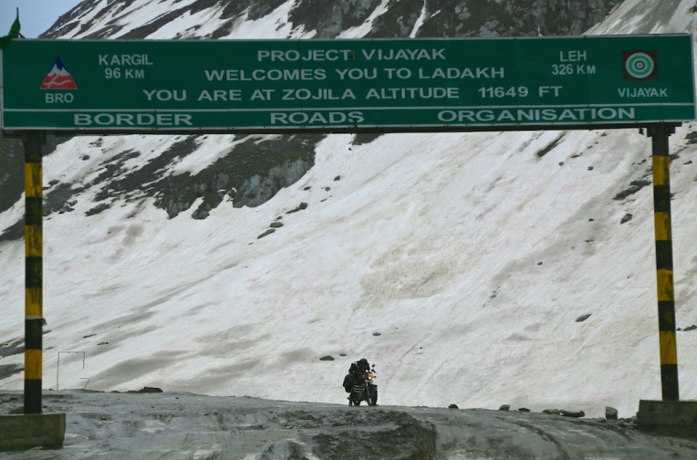

The roads to Ladakh cutting through the Himalayan mountain ranges are some of the most treacherous, especially the mountain passes like Zoji La (Zoji pass) notorious for being one of the riskiest mountain passes in the world. Although at an altitude of 3528 meters above sea level (11,578 feet), the Zoji pass is much lesser in altitude compared to other mountain passes we had to cross in Ladakh subnsequently, the khardung La for one is above 18,000 feet, the Zoji pass hold the distinction for being the most treacherous and is being billed as one of the riskiest mountain routes in the world. Well I got to find out for myself why.
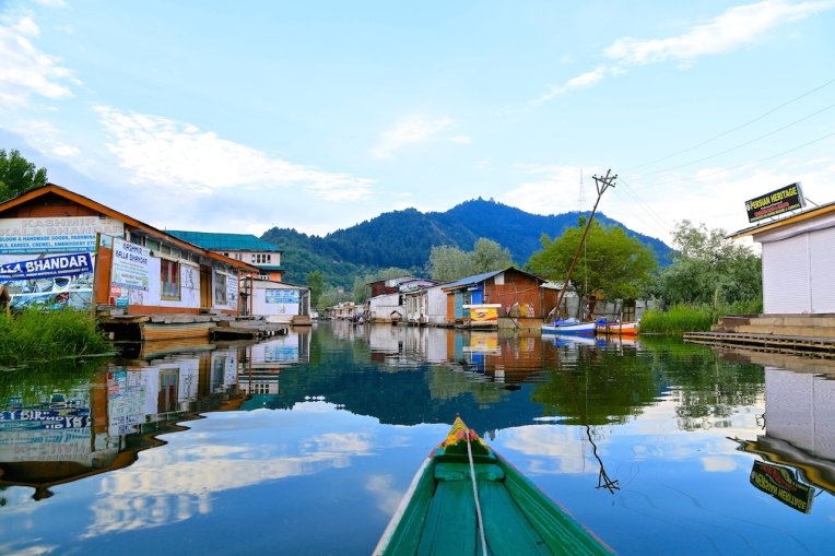
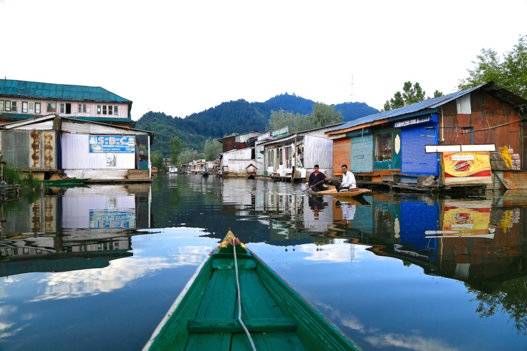
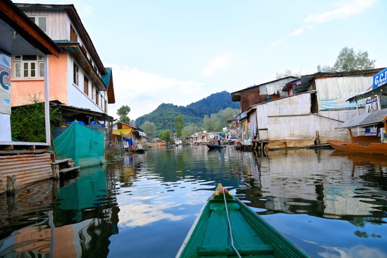
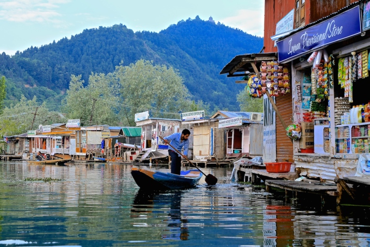
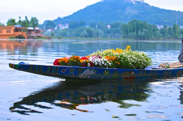
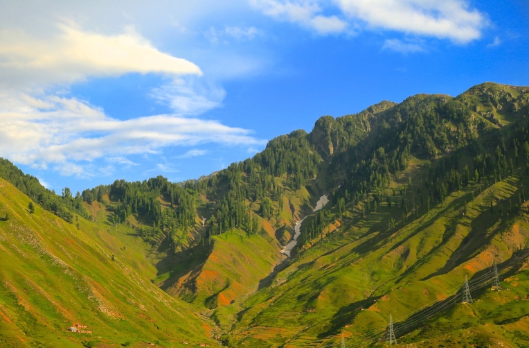
June 9, 2015, we left Srinagar after breakfast embarking on the National Highway 1 D which is more popularly known as the Srinagar- Leh highway. Coming from Delhi, this is a slightly more circuitous route than the Manali -Leh highway but I had chosen this route over the latter for the simple reason that the gradual ascent offered more time for aclimatisation to the higher altitude. Moreover the former is also famous for the magnificent vistas it offered of the beautiful Kashmir valley. True to the word, we passed through some of the most beautiful and picturesque locations offering magnificent views of snow capped mountain peaks amid lush greenery and foliage. Sonamarg which translates as “The meadows of gold” perhaps getting its name from the gently sloping meadows turning golden when the grass ripens, sits pretty on the slopes of the Himalayas, merely 85 kms away from Srinagar. Being a tourist hotspot, the place was crowded which was quite a put-off and we stopped only long enough for a quick photo shoot. From then on we clambered up the slopes of the Himalayas heading for the formidable ZOJI LA !
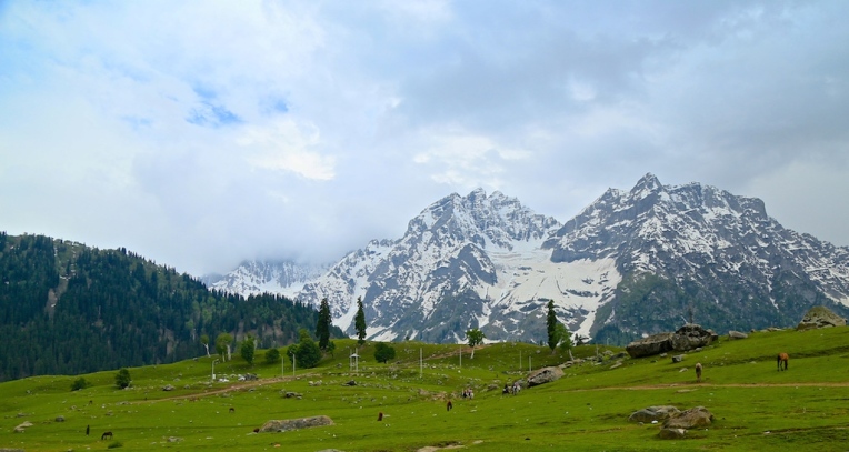

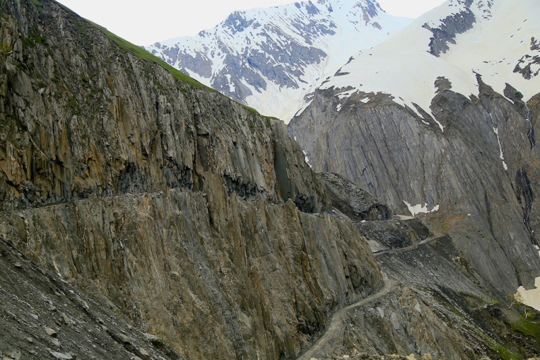
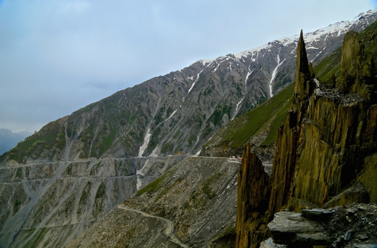
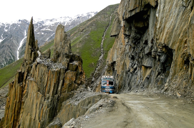
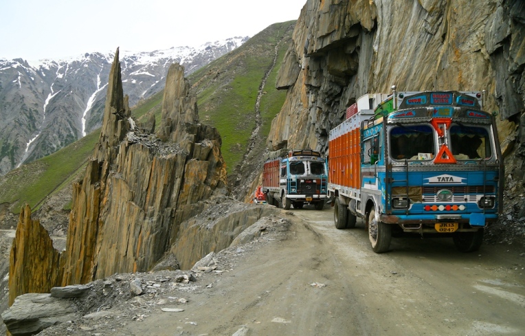
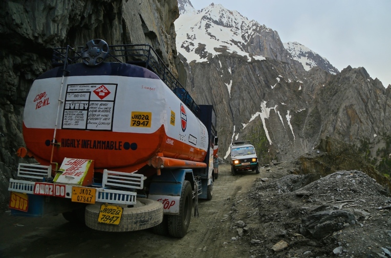
Leaving Sonamarg, the landscape began to change considerably. The green turned to grey, the two lane metalled road soon transformed into a single lane gravel and dirt road filled with slush and mud at intervals.The high point of this route is that the mountain trail is an engineering marvel of the olden days which was carved onto the steep mountain walls of the the formidable Zoji pass following the Indo-Pak conflict of 1947 to connect the isolated Ladakh to Kashmir. In the days of yore, Ladakh was an important post falling in the famous ancient Silk route providing passage from Central Asia through the Karakoram pass and down the Shyok river and then to Tibet via Demchok (on the Indo-China border). Following independence, these routes were sealed and Ladhak was choked off from the rest of the world. As an urgent measure a route was forged through the Zoji pass to join the Kashmir basin with that of the Drass basin on the either side of Zoji La effecting a road link between Srinagar and Leh. The pass became the gateway to magnificent Ladakh. Subsequently Ladakh was connected to Himachal Pradesh on the south eastern side through the Leh-Manali highway which is also of no less repute as it also passes through a number of formidable passes. Turning back to the mortifying route on notorious Zoji pass, we were now abreast with our first petrifying challenge of the trip. The hairs on the back of our necks were by now quite stiff and erect, a tingling sensation of fear slowly creeping up the spine. I told myself quitely “Fear is good, fear keeps you alert”. My co-passengers who were snoring until some moments ago were now quite awake but rather quite. I guess nobody wanted to speak much and left me much to myself to focus on my driving and the perrilous road ahead. Intermittently a word of caution would come from the back if I ventured too near the edge. Here there are no barriers to keep you from slipping off the edge into the 90 degree fall into abyss. The edge itself is crumbling at various places leaving you prone to being swept down the slope if one went too close to the edge. The high altitude, inclement weather and snow have played havoc on the route; landlides, rock falls, mud and slush being a permanent feature of the road. The BRO is being constantly engaged in keeping the road motorable and passable which opens up for traffic in the latter part of spring and closes off before the onset of winter when it is completely shut off by heavy snowfall. However commendable the efforts of the BRO, it did very little in terms of safety and convenience. The road is still what may have been in the ancient Silk route days ! We slowly inched up the 9 kilometers long crumbling dirt trail, negotiating through the hairpin bends and narrow ledge of a road; sometimes perched precariously to let an oncoming vehicle pass by and sometimes not able to move ahead at all because there just isn’t any space left to let anything by. But negotiate we did and managed to finally emerge on the other side that is the Drass basin with a big sigh of relief and an experience to cherish a lifetime.